travel / destinations


A couple of days ago, I shared a few photos from our visit to Omaha beach.

Today, on the sixty-ninth anniversary of the D-Day landings on the Normandy coast, I thought I would share a few more photos from our visits last week.

First, another look at Omaha …

.

.

.

A couple of views of the coast at Arromanches, and one from the cliffs, looking back toward the town itself …

.

.

.

.

Looking out to sea from the remarkable preserved-as-it-was-left German gun battery at Longues …

.

.

And, finally, several views of the craters, the gun-turret remnants, the cliffs, the coast, and the monument at Pointe du Hoc …

.

.

.

.

.

.

.

.

.

This is rather off topic, but I thought I would share another then-and-now set of photos from our recent trip. While we were in Normandy, we visited several of the D-Day sites, memorials, cemeteries, etc. One of these was Omaha Beach. I understand that one of the things that made June 6th, 1944, so incredibly difficult for the American soldiers landing on that beach was, in fact, the beach itself … it’s incredibly wide and flat and completely without cover from the gunfire that rained down on them. Those same features, especially if one is visiting on a cool, gray day when hardly anyone else is there, now make the beach a remarkably beautiful, peaceful place.

.

.

.

As we were leaving the beach, we walked for a bit along the trails on the dunes, which are now a nature preserve and filled with greenery, flowers, and birds …

.

.

And then we happened on to this, just over the crest of the dunes:

.

.

The visitor-information plaque says, “On 6 June, at around 10 a.m., hundreds of men were stuck on this beach amongst the destroyed landing crafts. In front of them was the small Ruquet valley, protected by two fortified points. Today, all that is visible is one large gun in its blockhouse [above]. It was hit by fire from an approaching vessel 1 km (1,000 yards) away, and was destroyed for good by a ‘half-track.’ The U.S. engineers immediately opened this road toward the plateau, and at around 3 p.m., the heavy U.S. equipment took this first, and only, cleared exit from the Omaha site. The 1st Division ‘Big Red One’ used the blockhouse as a command post, and soon, thousands of GIs took this road to liberty.”

This photo, from the information plaque, shows a 1944 view of the same blockhouse we visited, from about the same vantage point.

.

.

… Well, not really. We’re back home in Kentucky now. But, as I have so many photos to share, we’ll still be in France for quite a while here on the blog.

One of the villages we visited is called Creully, and we happened to visit while there was a small outdoor market in the square …

.

.

On one of the village’s tourist-information plaques, we saw this photo, taken from nearly the same spot as the one I took above, of an earlier market day … when all the vehicles were horse-drawn.

.

.

After a wonderful, busy trip through parts of Belgium and northern France, we’re leaving tomorrow morning for our (long) trip home.

A.J. and I have joked that (not counting a lovely couple of couple of days at the CIAT Cuts) this trip has been our “war and peace tour” … We’ve visited major battlefields, front lines, and cemeteries from the Hundred Years War, the French Revolution, the Napoleonic Wars, World War I, and World War II. And we’ve visited about fifteen gorgeous and varied old churches.

One of those many churches, in Caen, had some old photos on display … including this gem.
.

image

.

Yesterday, I asked what among the day’s various activities you might want to see photos of. I had only one response, but she asked to see everything. So here goes …

First, in the morning, we saw the open-air fish market in Trouville. I say “open-air,” but the market is actually in a building with all the various vendors having stalls that face the street. Their awnings were particularly useful yesterday morning, as we were there in the rain.

.

.

.

Right smack dab in the middle of Caen are the ruins of William the Conqueror’s castle. These ruins are of William’s castle when he was duke of Normandy (before 1066), and of a slightly later version that was built — next to the original — with stone fortifications instead of a wooden wall.

.

.

.

… The current castle’s walls and gates were added by laters inhabitants.

.

.

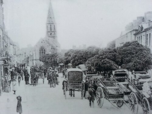
And across the street from all that is this magnificent church …

.

.

.

From there, we wandered down a pedestrian zone and happened into a small church with two naves and these unusual ceilings, which look like the (upside-down) insides of boats.

.

.

Last night and tonight, we’re in the adorable (tiny!!) village of Crepon …

.

.

.

Yesterday evening, we drove toward the beaches before dinner and happened onto a preserved-as-it-was-left German gun battery.

.

.

.

Today we drove to Omaha Beach. This evening, the beach and, at one end, the dunes (now a nature preserve) were beautiful and remarkably peaceful … but when you stand on the beach itself and contemplate the huge expanse of sand those soldiers had to run across while being shot at from the tops of the dunes and hills, it’s simply heartbreaking.

.

.

Just FYI: These are all photos that I took with my phone. Except for the few CIAT Cuts photos I posted recently, I haven’t even begun to sort through all the photos I’ve taken (and continue to take) each day with my “real” camera. We have two days of vacation left, and I’ve already got nearly 1,300 photos! Stay tuned …

« Previous PageNext Page »